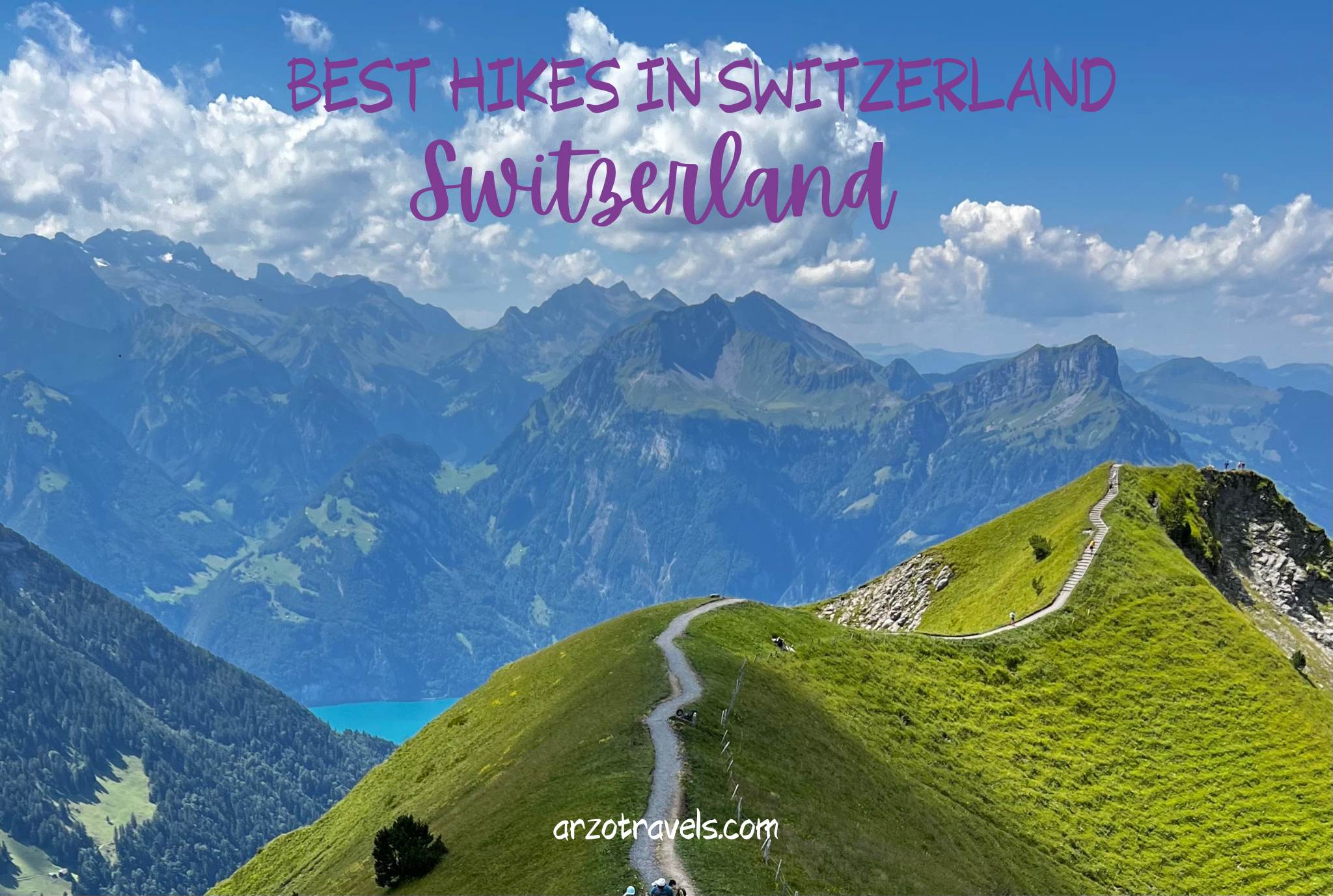
SWITZERLAND´S BEST HIKES – MODERATE HIKES, MAXIMUM EXPERIENCES
Are you ready to find out about the best hikes in Switzerland? Then buckle up – today, I am sharing my favorite intermediate Swiss hikes with you.
Switzerland has some spectacular hiking trails and breathtaking scenery. There are hikes suitable for all levels of hikers, from the easy beginner trails to the intermediate and more challenging routes.
For those looking for something a bit more adventurous but not quite ready for the extreme challenge of high-altitude alpine treks, intermediate hiking in Switzerland is the perfect option.
I am not ashamed to admit that I love the easy hikes the most – yes, I love an easy hike that still offers breathtaking panorama along the way. And yet, I also do the more challenging hikes in Switzerland. The so-called “intermediate” hikes. Why? I hate uphill hiking, and in Switzerland, many mountain views are waiting for us without any hike, BUT most often, the very best views come after we do a few extra miles.
Thus, I am sharing the hikes that are “doable” for people who are semi-fit. Hikes, which many people can do, but which might be still a challenge for us. And fit people will love these hikes even more because the views are great for all of us.
Before I talk about the 15 top hikes in Switzerland, here are some very important hiking tips.
WHAT IS AN INTERMEDIATE HIKE IN SWITZERLAND?
Hiking levels in Switzerland are typically divided into three categories:
- Easy – often marked T 1
- Intermediate – often marked T 2 and T 3
- Difficult – often marked T 4 and
- Alpine hikes – which include some serious climbing and are only for very experienced hikers (climbers).
Easy hikes involve short distances and very little elevation gain, often along flat terrain and easy paths. Intermediate hikes (or moderate hikes) generally require more stamina due to longer distances and more challenging terrain, such as climbing up mountainsides or traversing rough trails. Difficult hikes involve more strenuous activities such as scrambling, climbing, and mountaineering.
Intermediate /medium hikes in Switzerland tend to be between three and five hours long, with elevation gains of up to 1000 meters. They may also involve traversing various terrain types, such as forests, alpine meadows, and rocky passages. Depending on the region and time of year, these hikes will have different levels of difficulty – some may require more technical skills or longer distances than others.
When planning an intermediate hike in Switzerland, it is important to research the route beforehand and be prepared for the conditions. But no worries, this is what this blog post is for. Here are some of my most important hiking tips for Switzerland.
BEST TIME TO HIKE
The best time for hiking in Switzerland is from late May to mid-October when the weather is usually at its best and most trails are open. In the winter months, many of the mountain trails will be closed due to snow and ice, so it’s best to stick to lower elevations. Many paths are closed until April, and the high-elevation hikes are sometimes even closed until June.
Most of all, always make sure you check the trail conditions before you set out – they can change quickly in the mountains due to weather and other factors.
BEST SUMMER HIKES IN SWITZERLAND
So, without further ado, here are the best hikes in Switzerland (I will dedicate another blog post for some amazing winter hikes as well as easy hikes in Switzerland, but for now, it is all about the medium hikes).
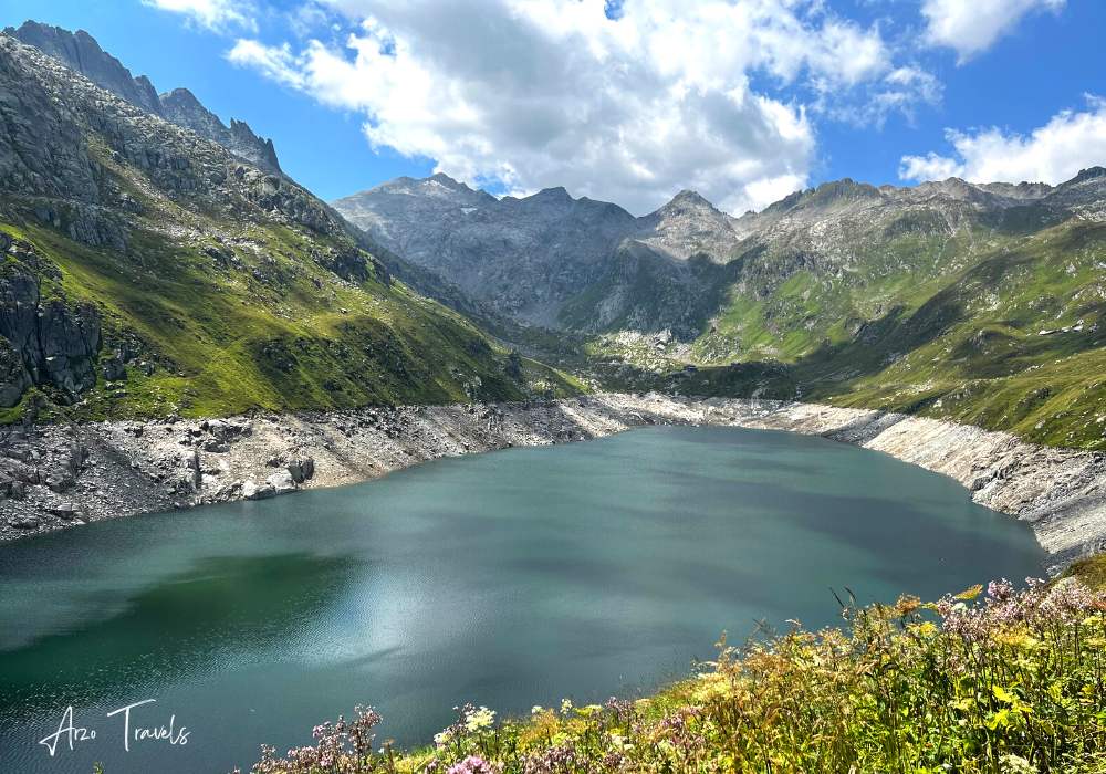
PIZOL 5-LAKE HIKE
EXPERIENCE: 10/10
Embark on an unforgettable journey and explore some of Switzerland’s most awe-inspiring mountain peaks!
The Pizol 5-lake hike starts from Wangs or Bad Ragaz – take the cable car to Pardiel station change to a lift and go to Laufböden (2226 meters).
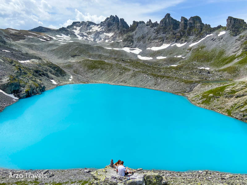
From there, start your hike. From Laufböden to Pizolhütte is about three kilometers, and this part is quite easy because it is mostly flat. The first lake you will see is the Wangsersee, a tranquil lake set high above the timberline. Your trail then continues to Wildseee—a dazzling turquoise wonder with panoramic views of the Pizol glacier and peak in the background.
Stop by Schwarzsee before winding up to Schottensee: a serene blue landscape where you’ll feel like time has stopped just for you! End your magical trip at Baschalva Lake – as it changes from deep green hues into romantic shades… this is one Alpine escape you should not miss out on.
Then you will be at Laufböden station again, where you can take the lift/cable car to get back to Bad Ragaaz.
This is such a great hike – memories that will last a lifetime. However, it is also one of the most popular hiking trails, so I do not recommend doing it during the summer months on a Sunday or national holiday.
- CANTON: Grison
- STARTING / END POINT: Bad Ragaz/Bad Ragaz (Wangs would also be possible, you can also start at one point, and end at the other)
- LENGTH: 10 km
- DURATION: 4,5 hours
- ELEVATION: 440 meters up / 790 meters down
- CABLE CAR: Yes, from Bad Ragaz or Wangs
5 LAKES WALK – ANDERMATT
EXPERIENCE: 8/10
Explore the majestic Gotthard Massif with a 5-lakes hike! Witness nature’s beauty up close as you trek along, passing emerald lakes and towering peaks of this picturesque region.
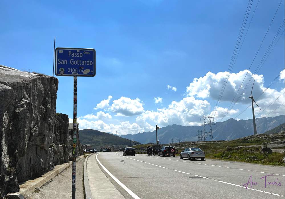
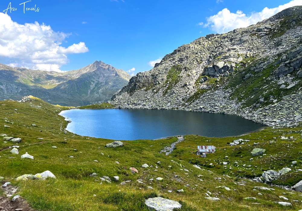
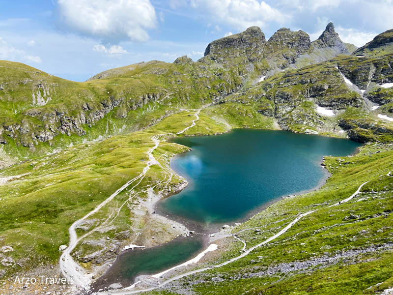
Set off on this challenging hike starting at the St Gotthard Hospice – the first three kilometers are a walk in the park! However, soon enough, you’ll be facing steep inclines leading up to Lake Lucendro. After conquering that peak and arriving at lake level, follow your True-North compass up towards Lake Orsino – 4.5 km of hills lie ahead!
Enjoy 2.5 hours of mountain trekking before you get to the breathtaking Lake Orsirora and Gatschola-Lücke viewpoints, where unparalleled views await in all directions!
After a great rest, make your way down the hill to Lake Lucendro for one last stop before heading back. Along the journey, they’ll get to take in spectacular views of several smaller lakes and two larger ones – it’s sure to be an incredible Alpine experience!
So hit refresh on your energy levels as you dive into this final stretch of adventure-filled enjoyment – your car is waiting for you at the San Gotthard Pass.
- CANTON: Grison
- STARTING / END POINT: San Gotthard Pass
- LENGTH: 11.5 km
- DURATION: 4,5 hours
- ELEVATION: 443 meters up / 443 meters down
- CABLE CAR: not needed
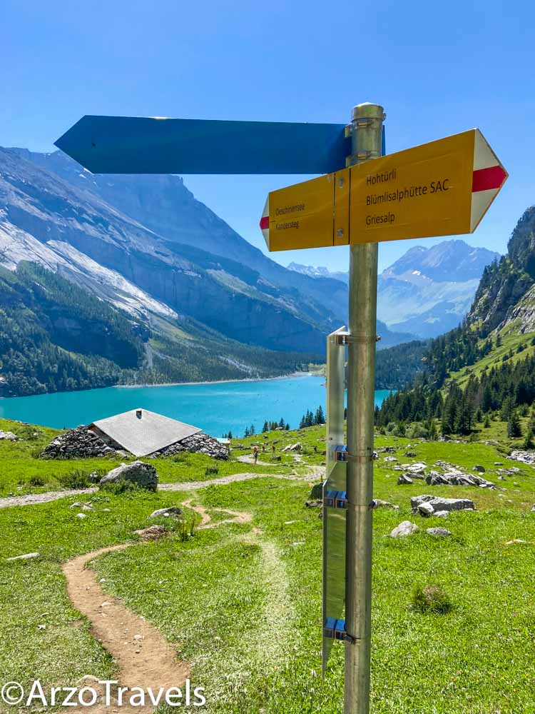
LAKE OESCHINEN HIKE
EXPERIENCE: 9/10
Take a thrilling ride up the majestic Swiss Alps to discover Oeschinensee, an awe-inspiring mountain lake nestled in Berner Oberland. Start your expedition from Kandersteg village and hop on board the gondola for a memorable journey!
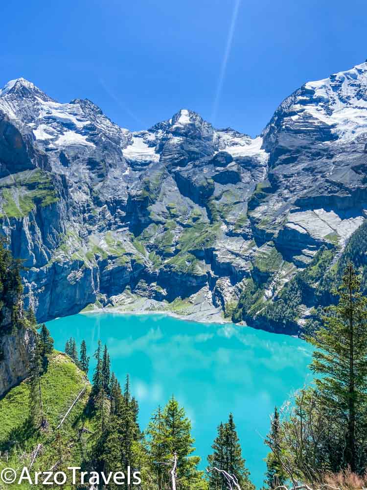
This hike starts at the top station of Lake Oeschinen – if you want more challenging hikes, you could skip the cable car and hike up from Kandersteg.
Embark on a spectacular hike above the stunning Oeschinensee Lake, where gorgeous mountain peaks and powerful waterfalls will take your breath away. And let’s not forget that breathtakingly bright lake!
The hiking trail along Oeschinen Lakes offers incredible panoramas of the Swiss Alps, perfect for experienced hikers seeking a challenge.
However, be sure to use caution as there are steep climbs with no safety railings – not ideal if you like keeping all four feet on solid ground or have small daredevils in tow! Take it slow, but enjoy every step: this is one vista-packed route that’s worth conquering. Find out more about this incredible hike here.
- CANTON: Bern
- STARTING / END POINT: Mountain station Lake Oeschinen
- LENGTH: 8,4 km
- DURATION: 3,5 hours
- ELEVATION: 443 meters up / 443 meters down
- CABLE CAR: Yes, from Kandersteg to Lake Oeschinen Mountain Station.
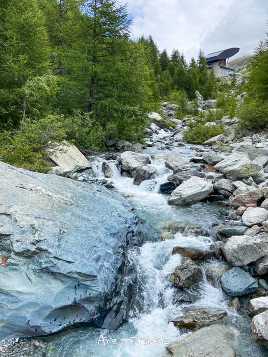
TRIFT BRIDGE HIKE
EXPERIENCE: 9/10
Ready to explore the wilds of Switzerland? Then head over to Gadman in Bernese Oberland! This cozy corner of the country is full of amazing discoveries, like the beautiful Gelmersee and Grimsel Hospiz. Or, for a truly unique experience, take on the Trift Bridge – it’s an unforgettable adventure that takes you deep into nature!
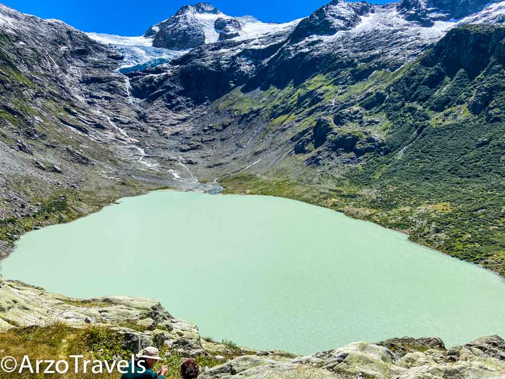
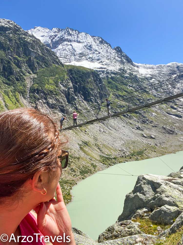
Start your journey at the summit station of the Trift cable car and hike until you reach an amazing bridge. Cross it for unbeatable views, rewarding yourself with one of nature’s most awe-inspiring sights of the Trift Lake and Trift Glacier.
The bridge itself is an attraction – and let me tell you, it has been the scariest bridge I have crossed so far. But that just added to all the fun I had.
This hike – so far – takes about 1-1.5 hours and is quite uphill – once at the bridge, you have several options.
Looking for a more exciting way back? How about taking the scenic winding paths of Ketteliweg (hiking scale T3)? The 30-minute uphill trek will take you to Windegghütte – just make sure your mountain goat skills are up to par when it comes time for descending!
Or take the same route back to the cable car station! For some extra hiking, you could skip the cable car and get to the valley station. Here is more about this beautiful Trift hike.
- CANTON: Bern
- STARTING / END POINT: Mountain station Lake Oeschinen
- LENGTH: 2,8 km
- DURATION: 3-4 hours
- ELEVATION: 424 meters up / 424 meters down
- CABLE CAR: Yes
LAKE GEMLER HIKE
EXPERIENCE: 10/10
May I introduce you to one of my favorite hikes in Switzerland? Hike around beautiful Lake Gelmer and get an unforgettable view of the stunning alpine landscape!
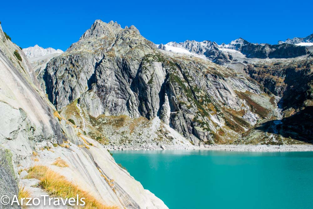
Take a trip on one of Europe‘s steepest passenger funicular railways, complete with drum-rolling for 12 minutes, that will take you way up and reward you at the end with an awe-inspiring turquoise mountain lake. The starting point for this hike is the Gelmerbahn summit station.
Soak in every detail as you make your way through natural brooks, rocky outcrops, and huge rock slabs.
If you’re brave enough to take it up a notch (and have no fear of heights), then stand at the dizzying cliff edge for stellar views over turquoise waters – just remember that sturdy shoes are essential here!
This hike does not include a lot of uphill hiking – the challenge comes because of the climbing section. My kind of hike! Also, this was my first “medium” hike in Switzerland, so I might be biased.
For the adventurous thrill-seeker, nothing quite compares to a hike from Lake Gelmer to Gelmerhütte! Along steep and winding alpine paths, this stunning route will lead you directly into Diechterbach Valley.
Get ready for an epic descent onto rocky granite cliffs that overlook magnificent views of the lake – but don’t forget your hiking boots. Here is more about this gorgeous, gorgeous hike.
- CANTON: Bern
- STARTING / END POINT: Mountain station Trift bridge
- LENGTH: 4.7 km
- DURATION: 2 hours
- ELEVATION: 170 meters up / 170 meters down
5-LAKE HIKE ZERMATT
EXPERIENCE: 9/10
With the majestic Matterhorn providing the perfect backdrop, experience an unforgettable 5 Lakes Hike in Zermatt’s stunning mountains, which starts at Blauherd station above Zermatt.
From incredible views of mountain lakes to varied terrain and more, this hike is guaranteed to make memories that will last a lifetime!
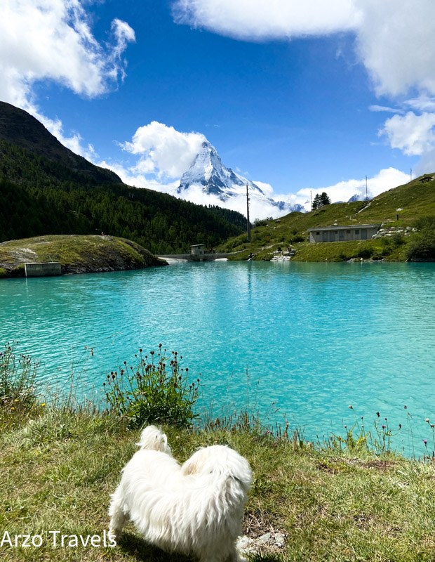
Explore the amazing lakes of Stellisee, Grindjisee, Grünsee, Moosjisee, and Leissee! Each lake has an entirely different vibe: The crystal clear waters of Leissee are perfect for a cool swim with kids, while nearby in Grunsees, you can admire Swiss stone pines dotting rocky landscapes.
Then take a wander around Grindjee’s rare wildflowers or marvel at the misty views over Moosjeese. In between, you will pass numerous waterfalls, streams, and more – just be prepared for a quite steep downhill hike at parts.
- CANTON: Valais
- STARTING / END POINT: Blauherd / Sunnegga (I actually hiked down to Zermatt village)
- LENGTH: 9,8 km
- DURATION: 3,5 hours
- ELEVATION: 165 meters up / 454 meters down
- CABLE CAR: Yes, to Blauherd and then from Sunnegga to Zermatt.
HIKE FROM MURTEL – FUORCLA SURLEJ – VAL ROSEG – PONTRESINA
EXPERIENCE: 10/10
It is time to talk about one of my all-time favorite hikes – from Corvatsch Mittelstation (Murtel) to Fuorcla Surlej, and then to Val Roseg, and from there to Pontresina.
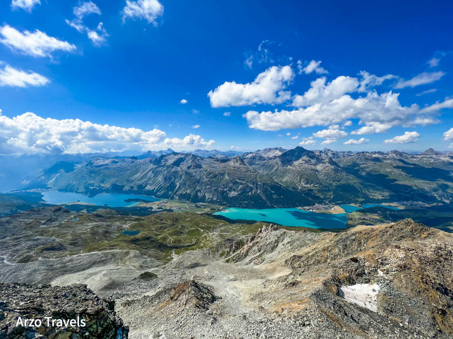
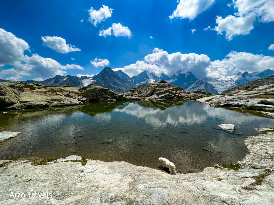
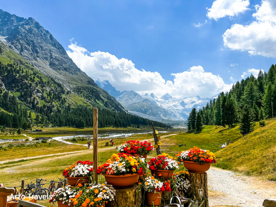
You have one of the most beautiful lakes in Switzerland, the mighty Roseg Glacier, and more. No, this hike will not disappoint.
The hike starts at Murtel Mittelstation (which you can combine with a trip to Piz Corvatch) and includes some uphill walking (from 2.698 meters to 2.753 meters).
There you have this gorgeous, gorgeous lake – Fuorcla Surlej! What a view!
After spending some time at Fuorcla Surlej, it is a steep downhill walk to Val Roseg. Yes, it is a steep hike, and it takes a couple of hours, but there is no cable car/gondola, so the hike it is. The views are impressive, and I really loved the hike because of the panorama.
Then, depending on the time of the day and your fitness level, you can walk closer to Roseg Lake and Roseg Glacier, which takes about 1 hour (one way) or you can start with the 5-kilometer-long, beautiful walk to Pontresina (1774 meters above sea level) – but there is not much up- or downhill hiking included, so it is really nice and relaxing!
- CANTON: Grison
- STARTING / END POINT: Corvatshc Murtel Mittelstation / Pontresina
- LENGTH: 13.5 km
- DURATION: 5 hours
- ELEVATION: 100 meters up / 1030 meters down
- CABLE CAR: Yes, to Corvatsch Murtel Mittelstation
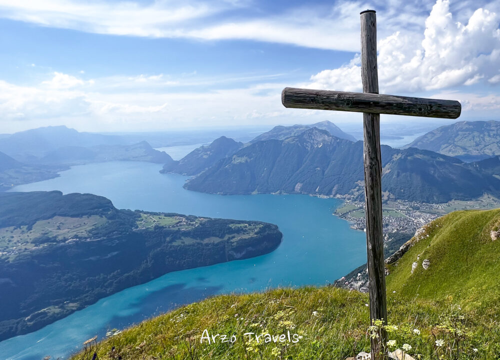
STOOS RIDGE HIKE – KLINGENSTOCK TO FRONALPSTOCK
EXPERIENCE: 9/10 – just because it is quite an overrun trail
If you feel like a real adventurer, then look no further than the famous ridge trail at Stoos in Central Switzerland near Lucerne! Take Europe’s steepest funicular train (with a 110% gradient) for an amazing ride up to Switzerland’s alpine village of Stoos.

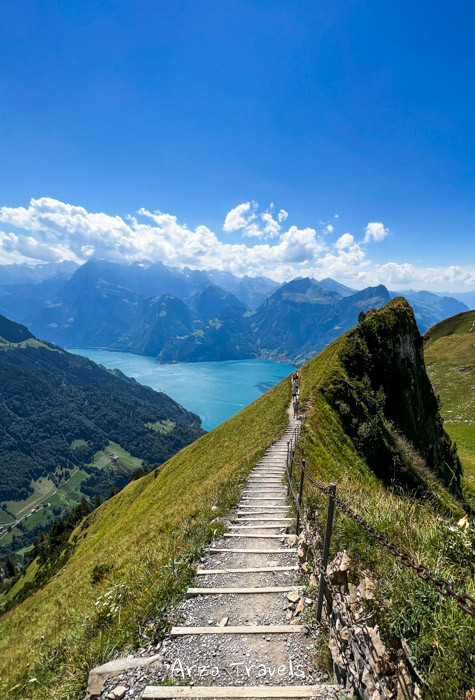
With its steep slopes and lack of railings, it’s sure to get your heart pumping. It does look scarier than it actually is, but only the steadiest hikers can tackle these tricky parts with confidence.
Hop on the chairlift and take it all in as you soar above beautiful vistas of 4,5 km along cliffs of pure magic – the hike is not long, but it is still a rather challenging one as there is a steepish uphill hike and climbs, and you should also be surefootedness and not be scared of heights!
Stunning views of Lake Lucerne and several other lakes are just the cherry on the top!
At Frontalpstock, you can catch another chair lift down – there is a reason one of the most popular hikes in Switzerland. Thus, it also gets quite busy on sunny days!
It should come as no surprise that I will make it my annual trek here; the views are that gorgeous!
ÄESCHER – EBENALP
EXPERIENCE: 9/10
Enjoy a unique mountain experience by climbing from Wasserauen station up to Ebenalp! Take in breathtaking views of Lake Seealpsee, complete with the mighty Säntis as your backdrop. For an even more amazing adventure, head over to Äscher restaurant tucked on the base of a sheer 100-meter cliff – definitely worth seeing for yourself!

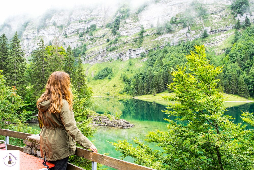
Go on a spectacular hike from Wasserauen railway station to the Ebenalp summit! The journey starts off with a steep climb up to Lake Seealpsee, where your reward will be stunning views of nature’s beauty.
After that comes the challenge: get prepared to test yourself as you ascend even more steeply along rocky paths until finally reaching breathtaking heights at Äscher mountain restaurant and then onwards towards Ebenalp summit.
Make Appenzell your base and end your town in one of the cutest Swiss towns.
FINAL THOUGHTS ON BEST SWISS HIKES
The best hikes in Switzerland will give you a chance to explore some of the most breathtaking scenery and attractions that this beautiful country has to offer. From exploring glaciers and vast alpine landscapes to enjoying local cuisine at mountain restaurants, there is something for everyone.
No matter your skill level or experience, these hikes have something special waiting around every corner that is sure to take your breath away. So what are you waiting for? Time to lace up those hiking boots and get out there and explore! Plan your next Swiss adventure today!